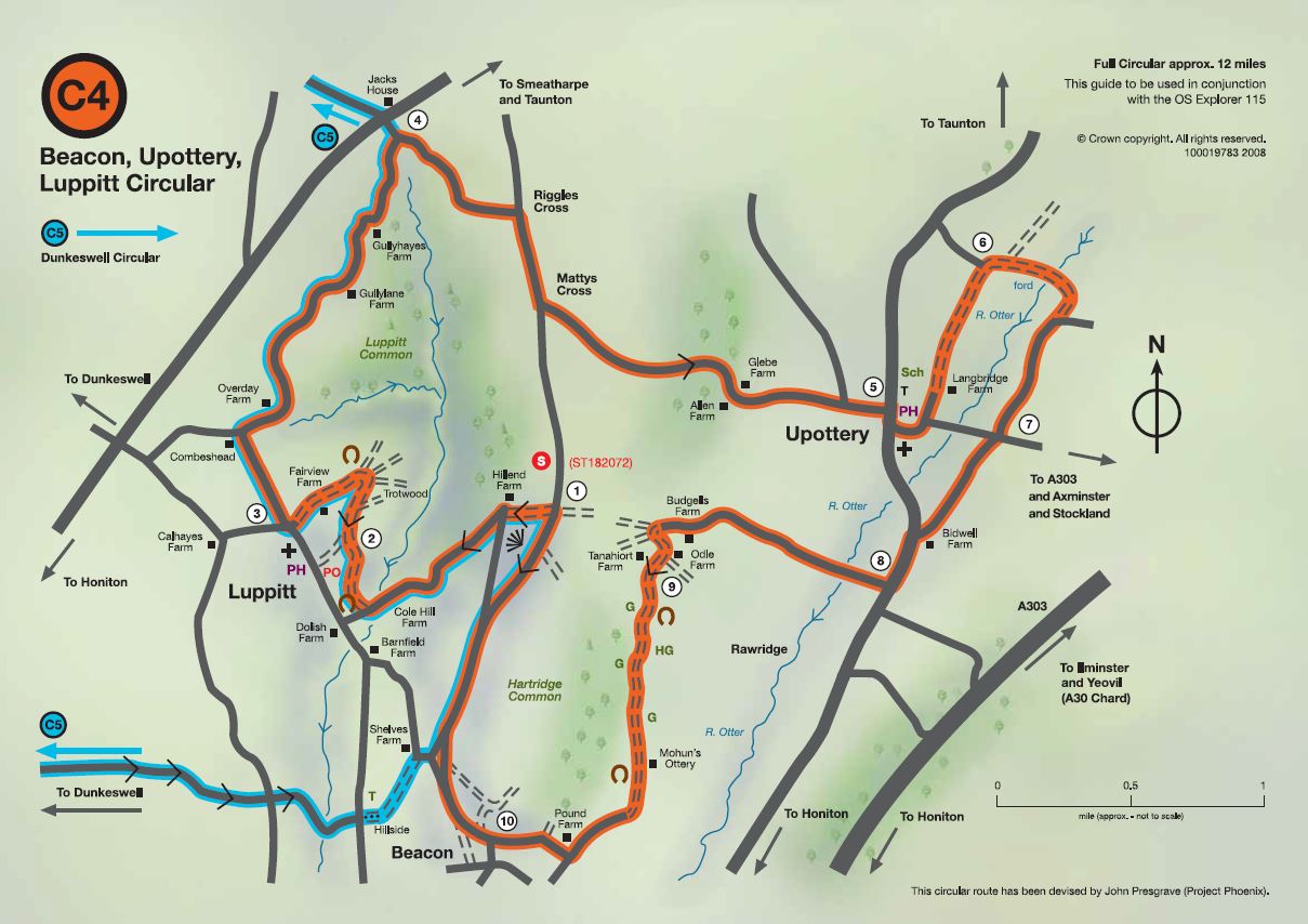
Easy difficulty. Distance 12 miles (19 km)
Wild and remote in parts, this 12-mile ride links some of the most picturesque villages in the Blackdown Hills. Hartridge and Luppitt commons provide a sharp contrast to the valley pastures. There are magnificent views across the Otter tributaries. Easy riding throughout but beware of traffic on the Upottery-Rawridge road. The ford across the River Otter may not always be passable. This is one of five horse-riding circuits in the Blackdown Hills National Landscape – route 4.
Riding Instructions (clockwise)
Orange line on map e.g. Start Point Hartridge Common (ST 182072)
1 Next R, down green lane, R at road and follow left round and down the hill, across stream and next R up BW over soft ground
2 Fork R at BW junction, and follow BW & way markers uphill & round to left, past Fairview Farm and along to RD
3 Sharp R at road, R at TJ and follow for one and a half miles past Gullyhayes to next TJ
4 R at TJ, then R at next TJ, and next fork L and follow road down to Upottery
5 R at village and next L behind PH, keep L and follow RD becoming unmetalled road for about 1/2 mile
6 R at TJ and keep R following green lane and fording River Otter, then continue along the green lane, then R onto RD till next junction
7 Cross junction then L at major road (Upottery-Rawridge-watch for traffic)
8 Next R, across River Otter along past Budgells Farm, then sharp L & pass between Odle and Tanahiort Farms and follow till it becomes a green lane and starts descending
9 Continue onto BW trough gates and past Mohun’s Ottery onto metalled road, R at Pounds Farm and onto Beacon
10 ST Beacon keeping right through common land and uphill to start point (1) availing fine views across the River Otter tributaries